

- cross-posted to:
- jaimelescartes
- cross-posted to:
- jaimelescartes
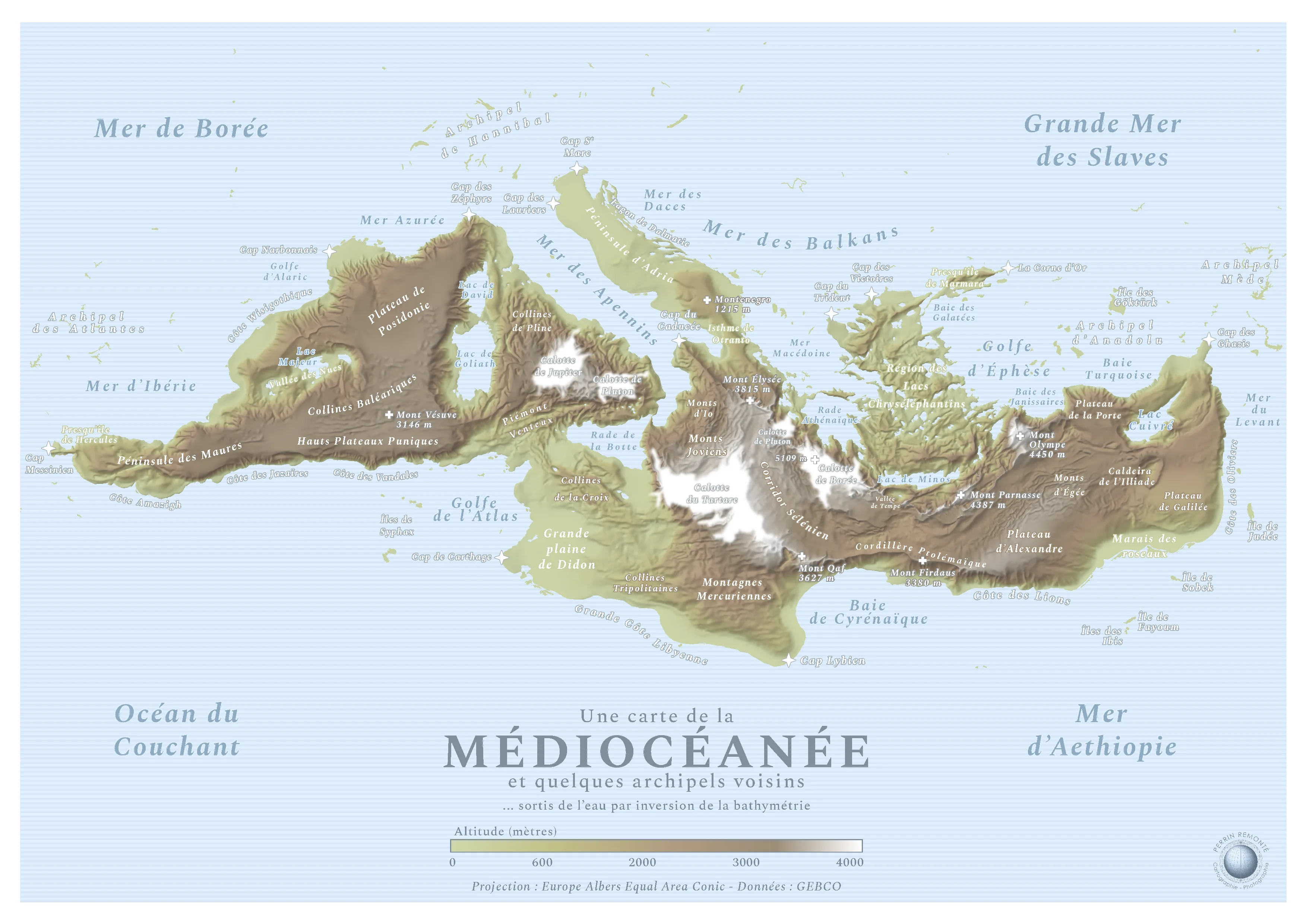
This is a map made by French cartograph Perrin Remonté:
Funny Sunday map interlude with a special map: it shows an imaginary continent hidden in the hollow of the Mediterranean, a name meaning “[the sea] in the middle of the lands”. This hidden continent is naturally “the land in the middle of the seas”, the Mediocean! The lands become seas and vice versa.
The black, inhospitable, cold and dark abysses become all white, covered with ice caps and beaten by high-altitude blizzards, like the Tartarus or Boreas caps which exceed 5000 meters in altitude, formerly 5000 meters deep while Mount Parnassus, Mount Olympus, Mount Qaf - real and legendary mountains - culminate at several thousand meters above sea level and still inspire beliefs and respect in these humans who look at them, fear them and admire them from the plains.
Sobek, Minos, Alexander, Alaric, Hannibal: the Gods, Kings and Queens rushed to give their names to these mountains, plateaus, seas, hills and coasts that emerged from the earth! It must be said that the Mediterranean is full of myths and legends, empires made and unmade, marvels of architecture or literature: the Caldera of the Iliad, the Peninsula of Hercules and the Bay of Galatea will be able to testify to this.
The map simply uses bathymetric data that I reversed, the rest is the result of intense internet research to find the best names. I am not Mediterranean for a penny, I have seen this sea once in my life but I tried to do it justice as best I could, it is a sacred piece of history and geography!
You must log in or # to comment.
This is groovy, love the mapmaker’s imagination! EDIT: typo
Shhhhhh. Thats where the greys live and work on their crafts.
Oh man your post is gonna get picked up as proof by r/ufos!
Doing a side-by-side, I realize they look pretty different, but def thought this was a Map of Roshar at first.


