Update Oct 2016: interested in a print? I didn’t make it, but I’ve seen this print and it is quite nice.
Maps of rivers, part of a vector tile project at github.com/NelsonMinar/vector-river-map. More information on my blog. See also Mike Bostock’s version at higher resolution with a better projection, the Pacific Institute’s version colored by flow, a global version by National Geographic, and the Hydrologic Map of Canada by Joy Charbonneau."


https://www.flickr.com/photos/nelsonminar/8747607969/
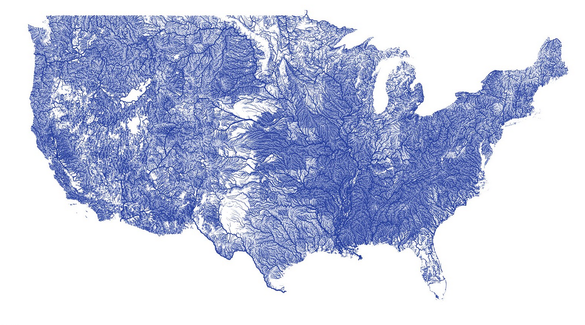
"US rivers in the contiguous 48
Update Oct 2016: interested in a print? I didn’t make it, but I’ve seen this print and it is quite nice.
Maps of rivers, part of a vector tile project at github.com/NelsonMinar/vector-river-map. More information on my blog. See also Mike Bostock’s version at higher resolution with a better projection, the Pacific Institute’s version colored by flow, a global version by National Geographic, and the Hydrologic Map of Canada by Joy Charbonneau."