The Picard Maneuver@lemmy.worldM to Cartography Anarchy@lemm.eeEnglish · 2 years agoThis would be the time to plan something without Australialemmy.worldexternal-linkmessage-square42linkfedilinkarrow-up1422arrow-down11
arrow-up1421arrow-down1external-linkThis would be the time to plan something without Australialemmy.worldThe Picard Maneuver@lemmy.worldM to Cartography Anarchy@lemm.eeEnglish · 2 years agomessage-square42linkfedilink
minus-squarebleistift2@feddit.delinkfedilinkEnglisharrow-up66arrow-down15·2 years agoRemember that it is always half of Earth that gets sunlight. This illustrates how much of the Pacific is missing in this projection.
minus-squareprotist@mander.xyzlinkfedilinkEnglisharrow-up66·2 years agoThere isn’t any of the Pacific missing in this projection…you can see right where it starts at the Bering Strait and ends in the exact same place. If this map were centered on the Pacific it would probably seem larger, but there’s none missing.
minus-squareinlandempirelinkfedilinkEnglisharrow-up39arrow-down1·2 years agoBro what you still think the Pacific is a real thing and not a random area invented by the government to have the world map look more satisfying
minus-squareChicoSuave@lemmy.worldlinkfedilinkEnglisharrow-up8arrow-down1·2 years agoSeriously. Have people never seen that part of the Pacific? Don’t just fly over it. Get out and touch dirt.
minus-squareMommy Longarms@sh.itjust.workslinkfedilinkEnglisharrow-up6arrow-down1·2 years agoPssh, spoken like a true sheep. I bet you think birds are real too.
minus-squareEch@lemm.eelinkfedilinkEnglisharrow-up27·2 years agoIt’s warped, not missing. Just like the resized continents are all there in full, just incorrect (relative) sizes.
minus-squareTonyTonyChopper@mander.xyzlinkfedilinkEnglisharrow-up18·2 years agoduring a solar eclipse less than half of the Earth is lit
minus-squaremilicent_bystandr@lemm.eelinkfedilinkEnglisharrow-up6·2 years agoobligatory your mum climbs a ladder joke
minus-squaremorphballganon@lemmy.worldlinkfedilinkEnglisharrow-up5·2 years agoBut on 4/20 more than half of the Earth is lit so it balances out

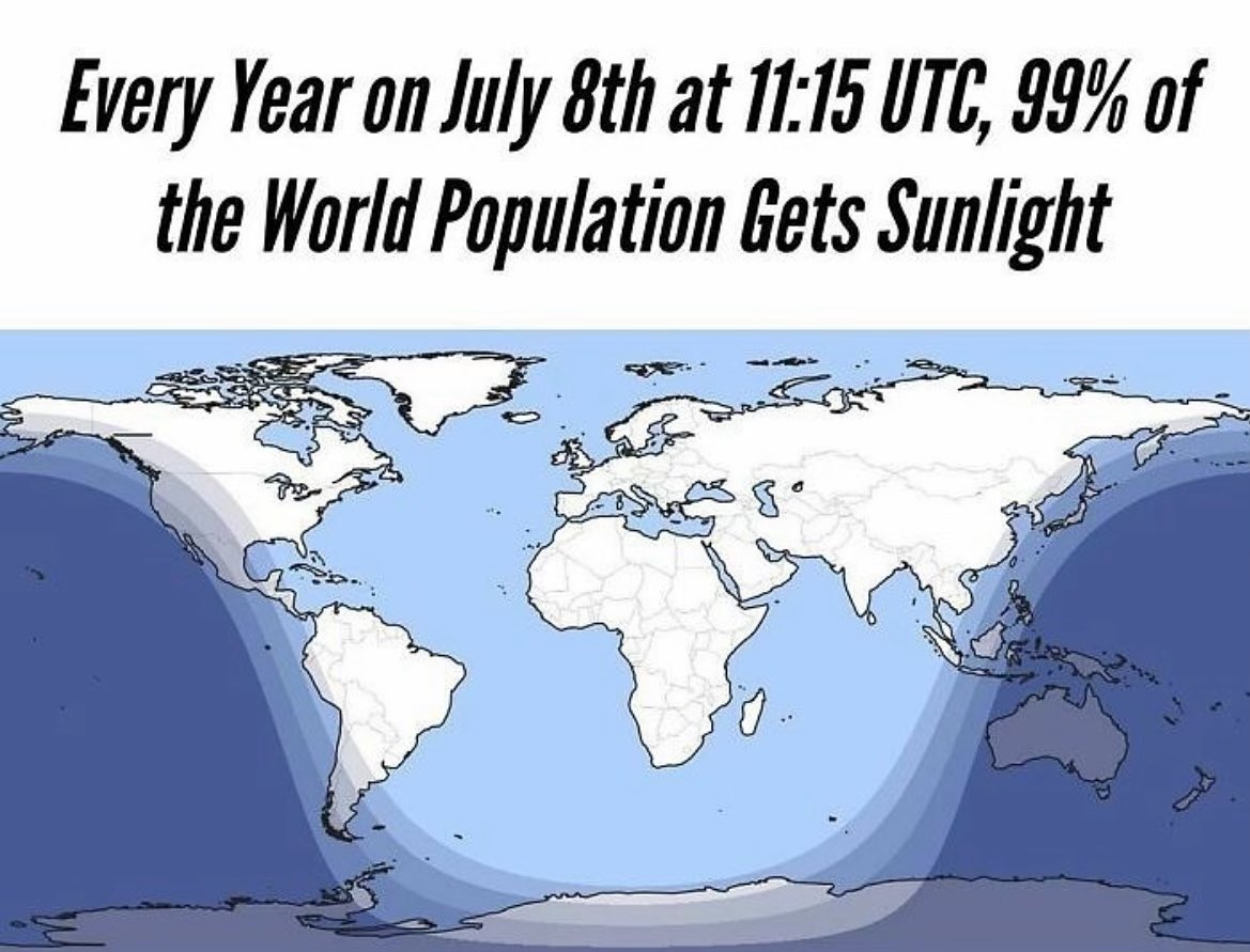
Remember that it is always half of Earth that gets sunlight. This illustrates how much of the Pacific is missing in this projection.
There isn’t any of the Pacific missing in this projection…you can see right where it starts at the Bering Strait and ends in the exact same place. If this map were centered on the Pacific it would probably seem larger, but there’s none missing.
Bro what you still think the Pacific is a real thing and not a random area invented by the government to have the world map look more satisfying
Seriously. Have people never seen that part of the Pacific? Don’t just fly over it. Get out and touch dirt.
Pssh, spoken like a true sheep. I bet you think birds are real too.
It’s warped, not missing. Just like the resized continents are all there in full, just incorrect (relative) sizes.
during a solar eclipse less than half of the Earth is lit
obligatory your mum climbs a ladder joke
But on 4/20 more than half of the Earth is lit so it balances out
Removed