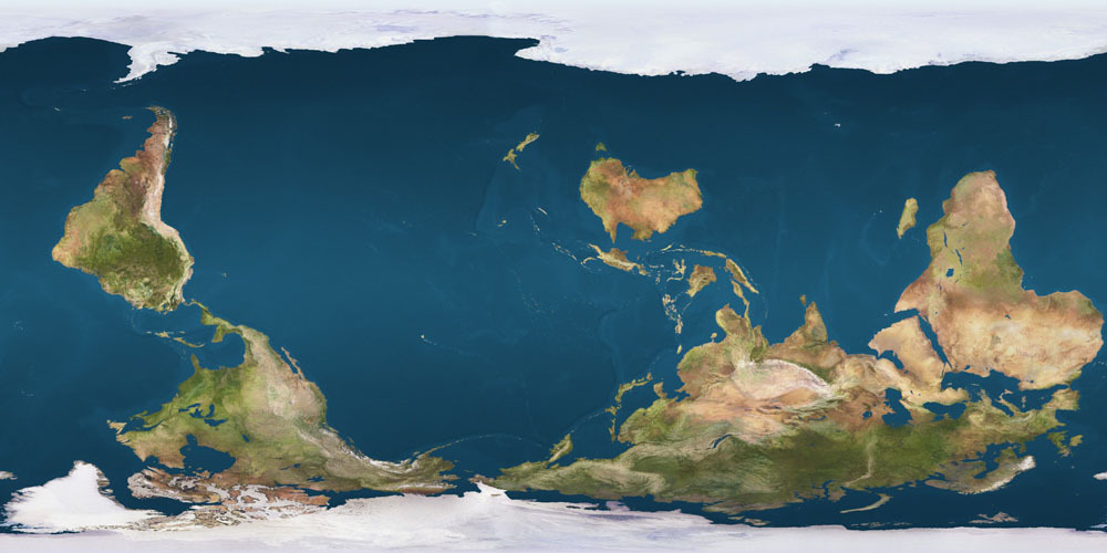
More noteworthy than the technical matter of orientation, per se, is the history of explicitly using south-up map orientation as a political statement, that is, creating south-up oriented maps with the express rationale of reacting to the north-up oriented world maps that have dominated map publication during the modern age.


It’s kinda weird.
Looking at the world maps, the South up maps on the wiki page and the others that come up with a quick ddg search, they look “wrong”, too bottom heavy. There’s something about Antarctica being the top of the map, with the broader section of ocean below it that itches in my brain, I think.
But, with the maps of smaller regions, like the European map on the wiki or the ones for the U.S. elsewhere, no objection from my brain.
I expected the unfamiliarity of the view would make it all feel wrong. I mean, I’ve seen south-up maps before, but never bothered to really explore them. I’m not sure why the world maps do it, but the regional ones don’t.
Looking at Atlantic-split maps that are north-up don’t feel “wrong”, it’s just a split second adjustment, and then it’s easy to find whatever.
It’s kinda bugging me that I can’t figure out why it’s only the world south-up that bugs me lol
maybe because the projection is less deformed when you take only a region?
i navigate with north as my point of reference but i can see how an east up map can be as natural (with the sun moving from top to bottom, i can still function)
but looking at a map where sun moves from left to right, i’m like you—it’s bugging me
You know what, I think that’s it! Thank you :)